Digital engineering solutions tailored to your needs
The analysis metrics and performance indicators it uses are based on the sound engineering expertise applied by our teams for the management of assets such as road, cycling, and pedestrian infrastructure or municipal infrastructure and buildings, as well as public, private or industrial pools of equipment requiring continuous attention in terms of management and planning.
Benefits
Centralized data
- Manage your assets in one convenient digital application for improved planning and decision-making
- Consolidate public and private data sources, including reference documents, codes and standards, and real-time data, such as highway traffic or weather data
Optimized investments
- Define and plan asset management in the short-, medium- and long-term based on age, condition, and alignment with your goals to extend infrastructure lifespans
- Optimize your investment strategies and maintenance programs by simulating various options to pinpoint the most suitable method to manage your assets efficiently
Transparent and responsible management
- Communicate your action plans more efficiently, while providing a global picture of your assets to demonstrate responsible asset management
- Enhance in-house communication and public transparency with clear action plans
A simple, intuitive, and scalable tool
- Display your data simply, intuitively, and uniformly in dashboards and as performance indicators that can be tailored to your needs
- Deploy your asset management platform gradually, based on your needs and at your own pace, from smaller assets to more complex and diversified groups of infrastructure
Sustainability
- Transfer knowledge of your infrastructure and track its condition and evolution
- Track the progress of your investments over time despite staff turnover
- Compare planned investment options with actual progress
Quick access to your data
- Display and organize large datasets as surveys and investigation methods continue to evolve rapidly toward automation
- Tetra Tech supports technologies such as photogrammetric or LIDAR surveys using drones and data processing using artificial intelligence (AI)
Solutions
The InfraVue360TM platform enhances Tetra Tech’s expertise in asset management and builds on Tetra Tech’s HydroWeb platform, which has been evolving for more than 20 years to support the management and operation of urban water systems. By integrating and processing vast amounts of data, the InfraVue360TM platform facilitates the consultation of information, enabling your teams to make enlightened decisions and optimize investments. It also centralizes data and extracts valuable and usable information.
Although the platform is cloud-based, your data remains your exclusive property, and its sovereignty is preserved.
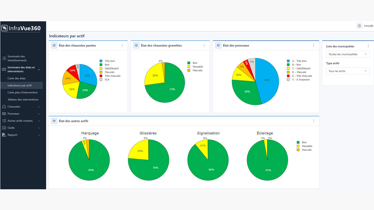
Infrastructure intervention plan
- Dashboards provide a comprehensive overview of global investment data
- Verified asset conditions and key indicators displayed on territory-wide maps, customizable by municipality or user jurisdiction
- Maps and tables display critical information on selected interventions for the options considered
- Predictive analysis capabilities provide projected asset conditions and related investment scenarios based on infrastructure and equipment degradation models
- Applications: An intervention plan for the rehabilitation of drinking water, wastewater, stormwater pipes and roadway/local road infrastructure plan
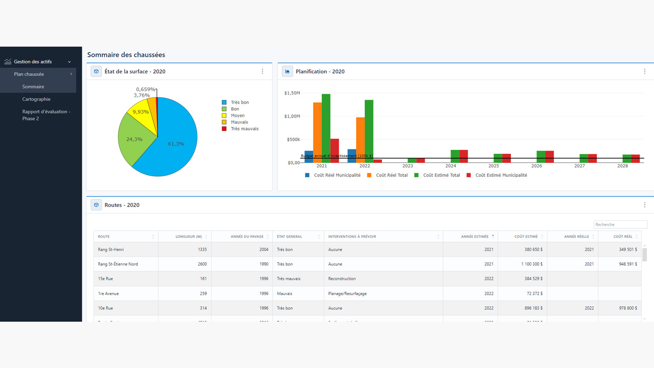
Municipal Assets Management Plan (MAMP)
- Dashboards provide a picture of the assets’ life cycles, service level assessments, and risk management considerations, including the impact of climate change
- View replacement options, upgrades, and asset maintenance on an interactive map
- Predictive cost analyses and current budgets, including financial summaries
- Information on investment monitoring and updates, as well as asset conditions over time
- Centralized access to multimedia data such as photos, reports, 3D models, and video
- Applications: Linear infrastructure (pipelines, roadways, bicycle paths, etc.) and facilities or equipment (pumping station, wastewater treatment plant, tank, sign, barrier, lighting, building, etc.)
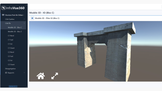
Equipment pools
- Maintain a centralized inventory of asset conditions based on field inspections and asset degradation over time
- Access the history of evolving asset conditions
- Assessments provide a global picture of the equipment pool as well as its standing in terms of life cycle
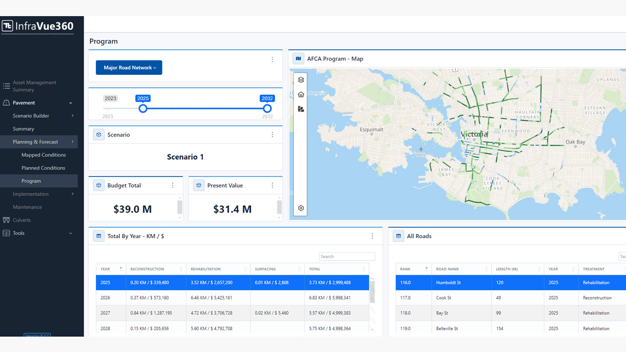
Investment planning
- Simulate short-, medium-, and long-term investment options
- Enhanced data and management strategies
- Prioritize interventions over time based on financial, technical, and organizational factors
- Decision-making tools
- Monitor selected options based on actual progress
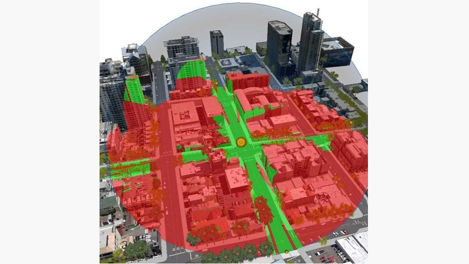
Data acquisition, drone surveys, and digital processing
- Leverage leading-edge technology to digitize and visualize assets such as roads, bridges, buildings, and tanks
- Acquisition of data on any type of land based on various constraints (spatial, traffic, access, remote areas, etc.)
- Data processing using multicriteria analyses and data from various fields, such as geophysics, hydrology, climate science, and statistics
- Capability to process data using AI
- Digital twin connectivity to monitor processes, infrastructure, and asset pools
- Virtual reality tools and augmented reality connectivity